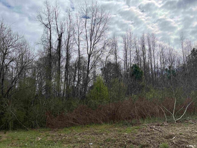
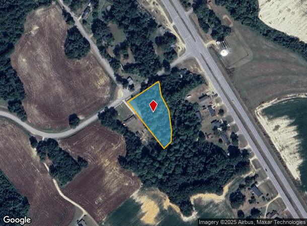
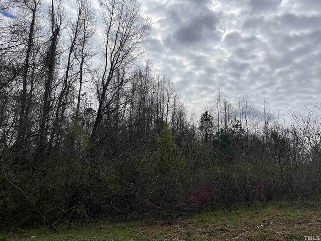
Property Record
73 Hall Rd, Erwin, NC 28339
NEARBY LISTINGS FOR SALE OR LEASE
Property Detail
73 Hall Rd
Dunn, NC
LT#2 ARTHUR JOHNSON SR MP#2012-512
070588 0110 01
Harnett
Agriculturalland
North Carolina
X
2
3720058800J
1.25 AC
2025
North Carolina Southeast Area
2025
Other Market Areas
070401
DEMOGRAPHICS near 73 Hall Rd
1 Mile
3 Mile
5 Mile
2024 Total Population
717
5,077
18,379
2029 Population
790
5,555
20,019
Pop Growth 2024-2029
+ 10.18%
+ 9.42%
+ 8.92%
Average Age
40
38
39
2024 Total Households
276
1,861
6,774
HH Growth 2024-2029
+ 10.51%
+ 9.94%
+ 9.48%
Median Household Inc
$63,450
$56,479
$52,223
Avg Household Size
2.50
2.40
2.40
2024 Avg HH Vehicles
2.00
2.00
2.00
Median Home Value
$193,570
$184,515
$160,065
Median Year Built
1986
1988
1981
Nearby Places
Map Layers
Map Styles
 Street
 Aerial
- Restaurants
- Banks
- Shops
- Fitness
- Groceries
PUBLIC TRANSPORTATION
AIRPORT
Fayetteville Regional/Grannis Field
DRIVE
WALK
Distance
Fayetteville Regional/Grannis Field
50 min
36.3 mi
Freight Ports
Port of Wilmington
DRIVE
WALK
Distance
Port of Wilmington
137 min
111.5 mi
SALE & LEASE HISTORY
LISTING DATE
SALE/LEASE

Sep 14, 2022
For Sale
Nearby Properties
Address
Land Use
TOTAL SIZE
Lot Size
Zoning
Address
Land Use
TOTAL SIZE
Lot Size
Zoning
90,007 SF
22.57 AC
Address
Land Use
TOTAL SIZE
Lot Size
Zoning
11,896 SF
1.61 AC
B2
Address
Land Use
TOTAL SIZE
Lot Size
Zoning
52.96 AC
Address
Land Use
TOTAL SIZE
Lot Size
Zoning
9,204 SF
9.64 AC
RA30
Address
Land Use
TOTAL SIZE
Lot Size
Zoning
14,400 SF
4.97 AC
COMM
Address
Land Use
TOTAL SIZE
Lot Size
Zoning
10,472 SF
1.97 AC
COMM
Address
Land Use
TOTAL SIZE
Lot Size
Zoning
5,676 SF
13.50 AC
RA30
Address
Land Use
TOTAL SIZE
Lot Size
Zoning
7,876 SF
10 AC
RA30
Address
Land Use
TOTAL SIZE
Lot Size
Zoning
13,450 SF
1.86 AC
RA20M
Address
Land Use
TOTAL SIZE
Lot Size
Zoning
5,580 SF
7.44 AC
RA
Address
Land Use
TOTAL SIZE
Lot Size
Zoning
9,888 SF
9.95 AC
IND
Address
Land Use
TOTAL SIZE
Lot Size
Zoning
67.37 AC
RA30
Address
Land Use
TOTAL SIZE
Lot Size
Zoning
5,218 SF
3.49 AC
RD
Address
Land Use
TOTAL SIZE
Lot Size
Zoning
4,769 SF
0.81 AC
R6
Address
Land Use
TOTAL SIZE
Lot Size
Zoning
3,724 SF
2.36 AC
RA
Address
Land Use
TOTAL SIZE
Lot Size
Zoning
6,250 SF
1.77 AC
RD
Address
Land Use
TOTAL SIZE
Lot Size
Zoning
38.29 AC
IND
Address
Land Use
TOTAL SIZE
Lot Size
Zoning
9,636 SF
3.79 AC
COMM
Address
Land Use
TOTAL SIZE
Lot Size
Zoning
6,762 SF
0.95 AC
B2
Address
Land Use
TOTAL SIZE
Lot Size
Zoning
2,280 SF
2.12 AC
RA40
Address
Land Use
TOTAL SIZE
Lot Size
Zoning
3,520 SF
2.23 AC
RA40
Address
Land Use
TOTAL SIZE
Lot Size
Zoning
27.99 AC
RA40
Address
Land Use
TOTAL SIZE
Lot Size
Zoning
33.76 AC
IND
Address
Land Use
TOTAL SIZE
Lot Size
Zoning
2,880 SF
4.22 AC
RD
Address
Land Use
TOTAL SIZE
Lot Size
Zoning
2,944 SF
1.22 AC
RA
Address
Land Use
TOTAL SIZE
Lot Size
Zoning
88 AC
RA20R
Address
Land Use
TOTAL SIZE
Lot Size
Zoning
5,208 SF
0.95 AC
RA20M
Address
Land Use
TOTAL SIZE
Lot Size
Zoning
7,500 SF
3 AC
M1
Address
Land Use
TOTAL SIZE
Lot Size
Zoning
16.77 AC
RA40
Address
Land Use
TOTAL SIZE
Lot Size
Zoning
1,373 SF
0.10 AC
The World's #1 Commercial Real Estate Marketplace
Connect with us
© 2025 CoStar Group
The information above has been obtained from sources believed reliable. While we do not doubt its accuracy we have not verified it and make no guarantee, warranty or representation about it. It is your responsibility to independently confirm its accuracy and completeness. Any projections, opinions, assumptions, or estimates used are for example only and do not represent the current or future performance of the property. The value of this transaction to you depends on tax and other factors which should be evaluated by your tax, financial, and legal advisors. You and your advisors should conduct a careful, independent investigation of the property to determine to your satisfaction the suitability of the property for your needs.